
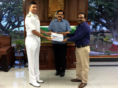
In a major development in ensuring security at the sea, the ICAR- Central Marine Fisheries Research Institute, Kochi has developed a GIS-based database about the marine fish landing centres along the Indian coast. The ICAR-CMFRI prepared the inventory of all the fish landing centres in the country, describing their GIS (Geographic Information System) location, types of fishing activity, seasonality of fishing and the extend of fishing operations from each fishing centres. Dr. A.Gopalakrishnan, Director, ICAR-CMFRI transferred the database to the Indian Navy to make the security measures in coastal regions easier.
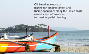
A team of Scientists, comprising of 22 scientists and 85 other staff, led by Dr A P Dineshbabu, Principal Scientist at the Mangalore Research Centre of ICAR-CMFRI prepared the inventory. The information about the landing centres and operational area of fishing will be useful in efficient marine spatial planning of various activities in the sea by protecting the security and livelihood concerns of the fisher folk along Indian coast.

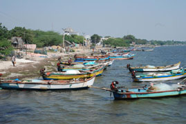
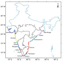
The database contains information on 1,278 landing centres along the Indian coast spanning all maritime States (Gujarat, 129; Maharashtra, 149; Goa,34; Karnataka, 93; Kerala, 201; Tamil Nadu, 359; Andhra Pradesh, 204; Odisha,54 and West Bengal,55).The database, providing an in-depth information base regarding fishing activities along Indian coast will help marine spatial planning in any development activities in the coastal region without impacting the livelihood issues of the coastal population.
According to Dr A Gopalakrishnan, Director of ICAR-CMFRI, the institute has a special interest in GIS based documentation of the marine fish landing centres since they are the reference points for mapping marine fisheries resources along the coast and such mapping will serve as the basic data for the fisheries conservation and management.
The geo-tags of marine fish landing centres is also a crucial work in facilitating national security. Fishermen can be considered as soldiers in the sea because they are constantly moving in and out of the sea scouting for fish at the same time observing some unscrupulous activities if any. The document will help the Navy, the Coast Guard and other security agencies in the disaster management as well.
(Source: ICAR- Central Marine Fisheries Research Institute, Kochi)


फेसबुक पर लाइक करें
यूट्यूब पर सदस्यता लें
X पर फॉलो करना X
इंस्टाग्राम पर लाइक करें